Project Description
Do You Have A Construction Project We Can Help With?
Gulf Surveys of Yemen (GSY)
GSY is a subsidiary company of ALDUHA utilizing the services of qualified surveyors and is aiming to establish itself as the Republic of Yemen’s primary survey company.
Using state of the art equipment, GSY is run by experienced Land and Engineering surveyor with years of experience in both the construction and oil and gas industries.
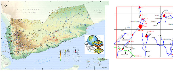
In year 2008, GSY provides GIS services and our clients include government, and oil companies. We created a high-quality tourism-related map that the Ministry of Tourism and the Yemen Tourism Promotion Board can utilize when promoting the Republic of Yemen as a tourism destination, as well as a map that the individual tourist can use in order to orient himself to the various tourism opportunities offered while in country.
Since its establishment, GSY’s role in clients’ GIS applications has been expanding and has included projects and contract work for government agencies and leading businesses. GSY delivers you the best services with emphasis on quality and customer service. Our goal is to support you by providing GIS Mapping Services, GIS Production Services, and GIS Consulting Services including needs analysis and implementation recommendations.

GSY employs professional surveyors using a wealth of experience to integrate data collection, processing and presentation systems. Strengthened by commitment to rigorous quality control, we offer a comprehensive survey package tailored to your individual requirements. We maintain a close relationship with a UK based survey company and a local engineering company, to enable flexible and reliable solutions for the client.
Our range of activities fully encompasses all aspects of the Land and Engineering Surveying industry :
TOPOGRAPHICAL & ENGINEERING SURVEYS
MEASURED BUILDING SURVEYS
MONITORING & UTILITY SURVEYS
BOUNDARY SURVEYS
GEODETIC CONTROL NETWORKS
LINE OF SIGHT DETERMINATION
OVERHEAD CABLE CLEARANCES
ROUTE SURVEYS
WELL LOCATION
Interfacing quality equipment with computerised data processing, results are quickly and efficiently achieved. Gulf Surveys expertise covers urban, rural and desert projects. Output is available as either finished ink drawings or in AutoCAD format.
GSY produces a detailed updated street map of the city using GPS techniques, including locations of major features such as oil companies, organisations, schools and banks. GSY produces the Sana’a, Aden, Masila, and Taiz Maps and updated Concession Maps.

